
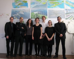
Rising Currents enticed hundreds of visitors to brave the cold and spend their weekend at P.S.1’s Saturday Sessions, exploring the Rising Currents open studios and listening to the architects-in-residence present their design solutions for New York’s rising sea level. The open house marked the official conclusion of the first phase of the Rising Currents project, the eight-week architect-in-residence workshop. Working together with MoMA’s Exhibition Design, Graphics, and Architecture and Design departments, the five multidisciplinary teams now move their projects forward by determining how best to transfer the results of their P.S.1 workshop processes into engaging design presentations within the context of a MoMA gallery. Below, the teams report on their final week in the workshop. A video of the presentations will be available on the Rising Currents website www.moma.org/risingcurrents soon.
Eric Bunge and Mimi Hoang, nARCHITECTS
ZONE 3:
In this last week of our workshop, the nARCHITECTS team focused on clarifying our concept of resilience. We illustrate this in animations at two scales: 1) REGIONAL: New York City will incrementally become resilient to sea level rise and storm surges through the deployment of dynamic, multilayered, and adaptive strategies. In our thinking about resilience we include social and economic in addition to climatic criteria. This animation traces a progressive extension of city life from land to water: subway stops; corridors of development and job creation towards the waterfront; new infrastructural piers/wave deflectors; a new tram loop encircling the entire New York harbor; ferry stations; infrastructural islands; inflatable barriers; housing + treatment wetlands; pervious infiltration network. These protective barriers, nodes of intensified urban programs, and networks of flows will promote human development and natural habitat to incrementally develop systemic resilience over time. 2) LOCAL: Infrastructural islands, located within the shallow areas of the estuary, create an archipelago of slowly accreting habitat. During a storm surge they also connect via inflatable barriers (“urban airbags”), forming a protective line of defense for the city’s new multilayered edge.
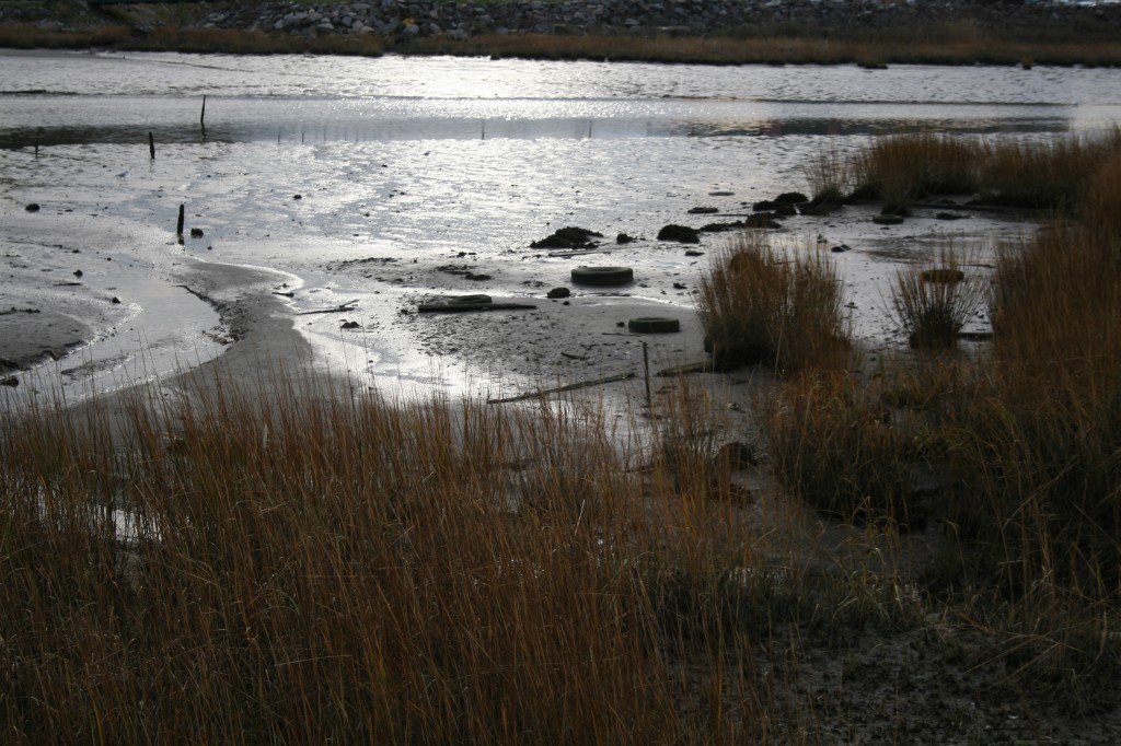
Kate Orff, SCAPE
ZONE 4:
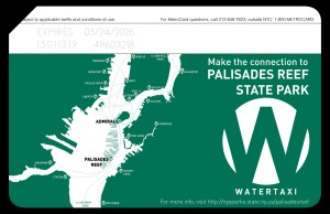
SCAPE's Palisade State Park Metrocard
The SCAPE team is detailing an oyster armature that forms a new public reef (Oysterpelago?) out in the Bay. The reef grows biologically over time to attenuate storm surge as oysters and mussels colonize the sub-tidal and inter-tidal reef netting, filtering excess nutrients out of the water. Impromptu islands emerge through the process of sedimentation in the slowed and protected waters of the flats, providing sanctuary for horseshoe crabs, marine birds, and the occasional seal. Public space with boat hookups, BBQ grills, diving platforms, and amphibious trails form a signature new regional “blue” park network. Palisades Bay Reef State Park is a harbinger of New York’s cultural return to its origins as a bustling harbor city and as the world capital of oysters. Get those Teva sandals on!
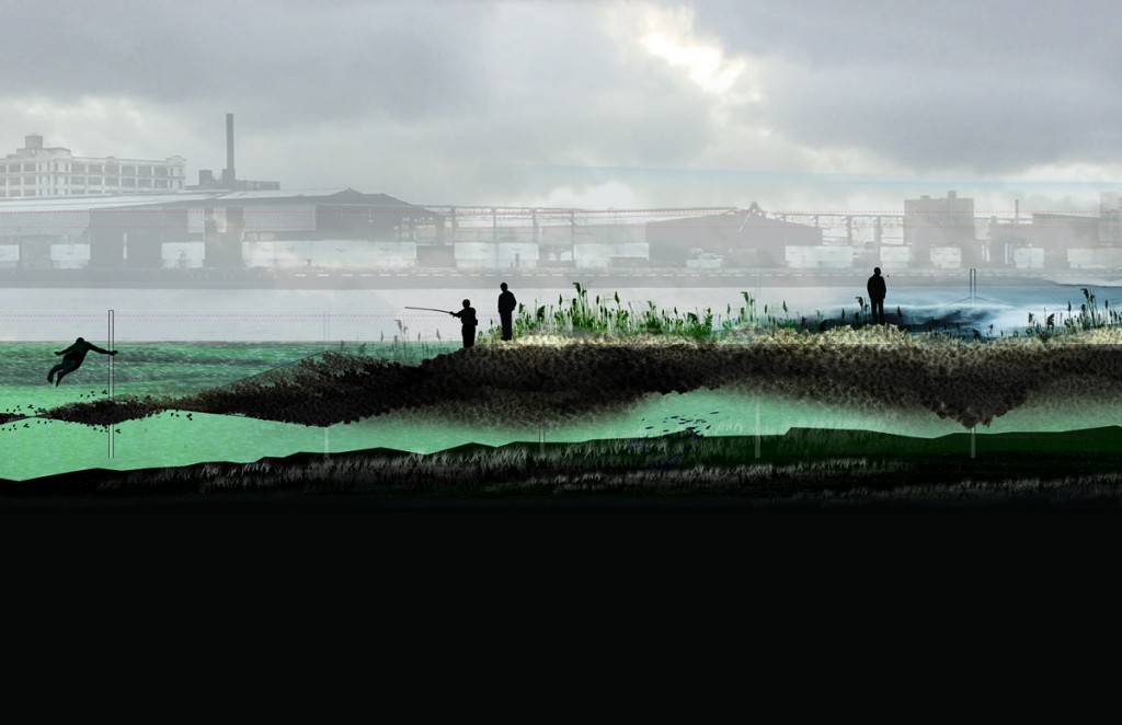
SCAPE diagram section
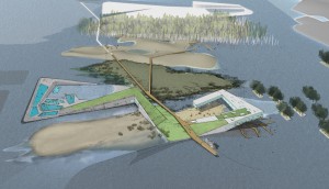
Adam Yarinsky, Stephen Cassell, Architecture Research Office (ARO); Susannah Drake, dlandstudio
ZONE 0:
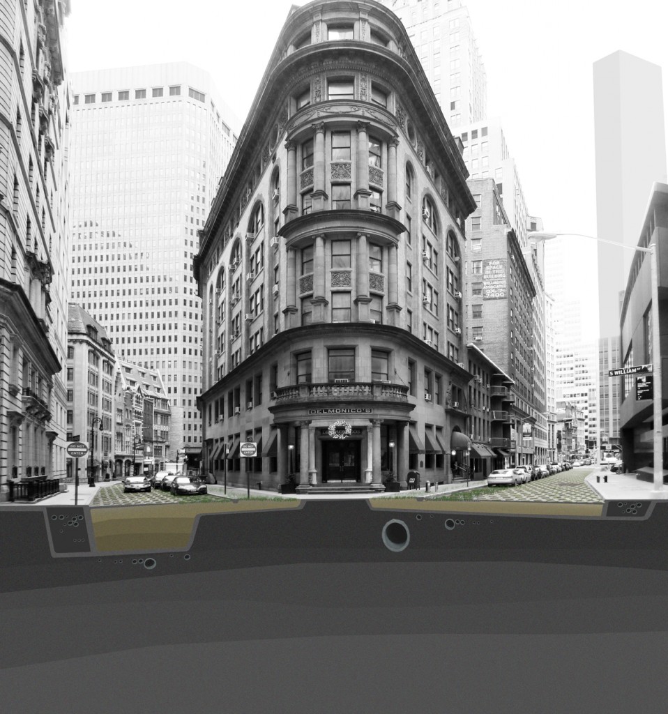
ARO southeast section
The City that Flows Two Ways
“Of course, native tribes had named the river long before Hudson’s arrival. One of their names—Muhheakantuck—means ‘great waters in constant motion,’ or, more loosely, ‘river that flows two ways.’ It highlights the fact that this waterway is more than a river; it is a tidal estuary, an arm of the sea where salty sea water meets fresh water running off the land” (from the New York State Department of Environmental Conservation website).
We propose a reframing of Manhattan’s relationship to the water as a response to the threat of rising sea levels. Rather than creating a wall to separate the city from the rising waters, we propose the integration of a new ecosystem into the city’s existing infrastructure. This new, reflexive ecological system will create a mediated edge between the city and the water that surrounds it, transforming the city in both use and experience. We see this as the next step in the evolution of the city; a new model of urban infrastructure.
Our proposal consists of two basic components that form an interconnected system: wetland edges and filtering streets. The water’s edge is transformed from the present hard sea wall to a gradient composed of three ribbons of open space: a public parkway, fresh water, and salt-water wetlands. Within the city, street infrastructure is rebuilt into a connected series of porous conduits that drain rain water and storm water into the wetlands. These streets continue up to the elevation flooded by a category two storm surge. Water will be the new connective tissue between the city and the harbor.
David J. Lewis, Marc Tsurumaki, Paul Lewis, LTL Architects
ZONE 1:
LTL's Zipper Plan
LTL Plan
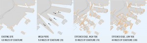
During the last two weeks of the studio residency at P.S.1, Team LTL Architects has developed its final design, proposing a new engagement between water and ground for Site 1. Based on current estimates, an anticipated four-foot rise in sea levels will cover over 80% of the site with water during high tide. The design proposal first adjusts the topography to turn the predominantly flat site into a terrain with subtle variation in ground height and water depth. Secondly, the coastline is lengthened by over ten times, establishing multiple opportunities for productive exchanges while providing the needed buffer to mitigate storm surges. By proposing an extensive range of types of engagement between land and
Team LTL
water—from hard edges to gradual slopes—the site is activated by tidal changes. Local areas are open for testing productive new uses, from agricultural fields to aquacultural zones, and from protected existing biological reserves to tidal research fields. A new series of program anchors, including an aqua-hotel, an open-air concert dock, a regional terminal produce market, and a research station complement and enhance the existing tourist sites of Ellis Island and the Statue of Liberty, amplifying the uses of the area. In short, the proposal seeks to turn the rising water level into a catalyst for rethinking the nature of the current park, creating a proving ground for future engagement of the local area, while offering a strategy for similar sites around the globe.
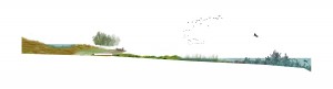
Matthew Baird, Matthew Baird Architects
ZONE 2:
Bayonne Saltmarsh, Team Matthew Baird
Team Matthew Baird section
PERDITA:
For I have heard it said
There is an art which in their piedness shares
With great creating nature.
POLIXENES:
Say there be;
Yet Nature is made better by no mean
But Nature makes that mean; so over that art
Which you say adds to Nature, is an art
That Nature makes(…) this is an art
Which does mend Nature—change it rather; but
The art itself is Nature.
–William Shakespeare
As we conclude our workshop at P.S.1, we reflect on this passage from A Winter’s Tale. We believe that there is indeed an art that adds to nature, mends nature, adapting to the change of a rising sea. New building systems enhance ecosystem functions. Though our proposal is theoretical, we think of the people and environment of the future as our clients. Our vision—encouraging salt-marsh accretion, re-creating underwater architecture by reef building—allows nature to do the work that only it can do. People need these habitats not only for their resources, but also for ephemeral reasons: mental and emotional succor, happiness, and even the love of art itself.