
As the hustle and bustle of the holiday season took over New York City in the past weeks, the Rising Currents architecture teams-in-residence enjoyed the winter wonderland from their studios at P.S.1. The teams are engaged in the final production push before the Rising Currents workshop concludes this Saturday, January 9, with a (last!) opportunity for the public to visit the teams in their studios and learn about and discuss the five projects addressing New York/New Jersey’s imminent rising sea level. As part of P.S.1’s Saturday Sessions, the studios will be open from 2:00 to 6:00 p.m., and a presentation and public Q&A session will take place from 3:00 to 4:30 p.m. Don’t miss this opportunity to weigh in on the next phase of New York City’s [g]local designs for the future! The Rising Currents exhibition will open at MoMA on March 24.
Film shot by Robin Urban Smith.
Above, Barry Bergdoll, The Philip Johnson Chief Curator of Architecture and Design, talks about the overall goals and challenges of the Rising Currents project. Also, stay tuned to the blog for Rising Currents updates from leaders in ecology, architecture, engineering, and civic administration.
Matthew Baird, Matthew Baird Architects
ZONE 2:
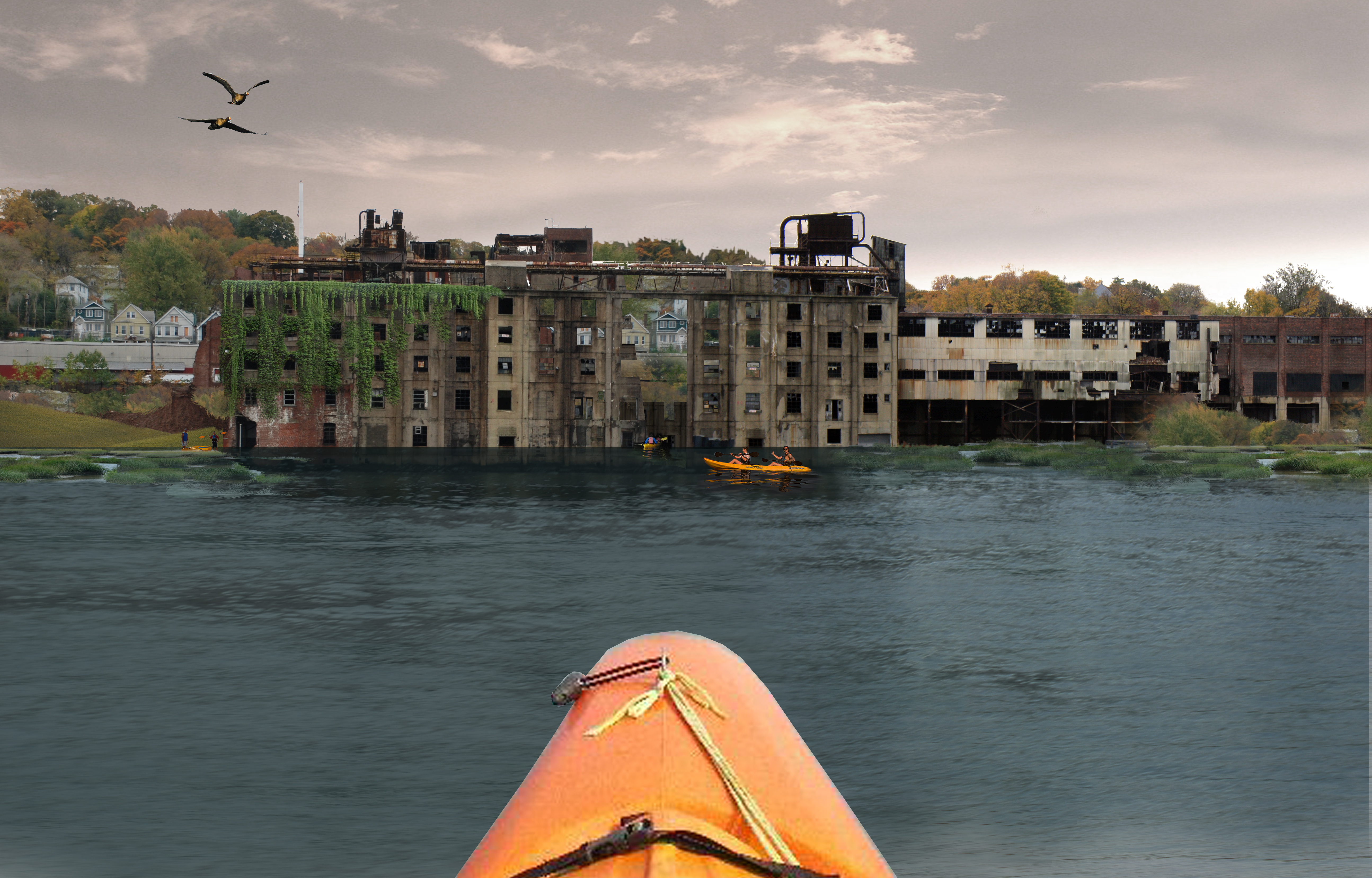
Team Baird abandoned site
In designing for the rising sea level at the Kill van Kull/Bayonne site, we are wondering how we can create an infrastructural territory for future expansion by occupying the revitalized ruins of an industrial past? We raise this question at a multiplicity of scales, zooming from the aerial perspective to the view on the ground to the specifics of found objects and a new material palette. In the beginning of our process, we imagined an architectural expression in which buildings and program were additive elements to this new watery edge. Now we see the architectural expression reaching beyond the conventional limits of architecture as building, and instead view our task as designers of an intricate and self-perpetuating system.
Eric Bunge and Mimi Hoang, nARCHITECTS
ZONE 3:
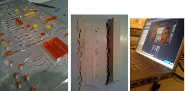
From left to right: laser-cut acrylic map indicating “Seeds” and “Flows”; axonometric model; nARCHITECTS via Skype.
Plant Seeds; Link Seeds; Instigate Habitat: Resilient City! This mantra continues to organize our thinking. Within this framework, we locate design opportunities versus aspects of the “new aqueous city” that should either emerge from zoning or the natural accretion of habitat. As we test and finalize representational techniques for final production, we are using these to interrogate the design decisions we have made so far. Illustrated here are tests for two of our wall elements: a laser-cut acrylic map indicating “Seeds” and “Flows,” and a fragment of our aqueous city blocks, represented as an axonometric model (slightly 3-D). Over the holiday break, the nARCHITECTS team stayed in touch via Skype.

Oysters will remain inedible for years to come while they are hard at work cleaning the water.
DON’T EAT ME! OYSTERS AT WORK. How to model organic change and growth? How to design for ground-up community-based collaboration? Our project envisions a new joint water-land-scape that grows organically over time alongside the threat of climate change. Rather than a top-down master plan, SCAPE is developing a toolkit for the next century and is sketching out physical armatures that support growth and new forms of culture. If the twentieth century brought bulkheads, dredging, flat muck, heavy industry, and contamination to the water’s edge, the future landscape toolkit consists of FLUPSYs, CSO sanctuaries, wave-attenuating oyster parks, and a nuanced, dynamic edge that supports living with the water in a phased approach that gets more intimate as water quality improves. Eelgrass, oysters, and mussels jump-start the cleaning process; cormorants, regional industry, floodable structures, fisher-businessman-commuters, Harbor Schools, and water-based regional economies and social networks evolve in tandem. Pictured here is a new above- and underwater scaffolding for oyster reefs that is woven from fuzzy rope. It generates a new public landscape for the New York Harbor and enables a new [cleaner, protected] water-based Gowanus community to take shape in the inland zone.

SCAPE Study Model of New Oyster Reef, Bay Ridge Flats
Adam Yarinsky, Stephen Cassell, Architecture Research Office (ARO); Susannah Drake, dlandstudio
ZONE 0:
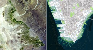
Ecostructure and team ARO's Lower Manhattan Site
Ecostructure. We have repeatedly used the term ‘inverted Central Park’ in our descriptions of our work in lower Manhattan. Olmsted and Vaux’s great masterpiece, now woven seamlessly into the urban fabric of New York City, is as monumental as the iconic skyline. What differentiates Central Park from many urban open spaces such as Union Square, Madison Square, Gramercy Park, and Hudson River Park is its connectedness to both the urban and ecological systems of the metropolis. With the impending sea level rise we envision a new paradigm for the relationship between water and land; a new ecological infrastructure which includes both built and soft elements. Nature is challenging to precisely contain without maintenance and control. Our proposed infrastructural system, based on reciprocal flows with different temporal periods, combines constructed and emergent natural systems in a transverse weave that makes the rising tidewaters of the next century productive. Cyclical cleansing of the new systems to control establishment of fetid eddies of filth requires new infrastructural forms based on geomorphologic structures that work with urban applications. In other words, natural and constructed systems need to be synchronized.
In the context of MoMA’s exhibition, the introduction of natural systems into the city may be looked at with skepticism, especially in lower Manhattan. What structures will need to be established to pay for this care? How will wildlife be managed? Ecosystems for desirable species may also harbor pests that spread disease, plague, and epidemics. Frederick Law Olmsted’s experience as a farmer helped him understand landscapes from a systematic standpoint to ameliorate many of these concerns and create benefits. He understood climate, weather, geology, soils, subsurface hydrology, and microorganisms. He also really understood drainage. Flow is critical to cities and landscapes and in our design the disparate structures of both are combined.
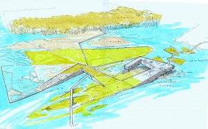
David J. Lewis, Marc Tsurumaki, Paul Lewis, LTL Architects
ZONE 1:
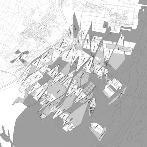
LTL updated site plan
In the last week, Team LTL has concentrated on the opportunities afforded by the impact of rising tides. We are diving in more detail into the programmatic possibilities enabled by the complex interactions between various states of water and differing heights of land. We have continued to develop the specific future uses and inhabitants of each of the four fingers, while simultaneously stitching the site back into the existing urban context that frames the current site. As such, we are seeking to challenge the current physical barriers that isolate Liberty State Park—roadways, abandoned canals, railroad lines—by allowing the flow of both rainwater and rising sea levels to establish new connections and linkages. Through this design process, the one thing that remains constant is paradoxically always in flux: the circadian transformation of the local landscape and the water’s edge created by tidal differences, exacerbated by the anticipated increase in global sea level. The design object is thus quite clear: to establish new landscape and water relationships that maximize the productive—in the broadest sense of the term—engagement of the site.
Sketch view of eco-hotel mingling with adjacent spa and existing botanical garden