
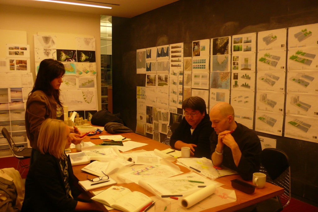
The five Rising Currents architect-in-residence teams have been playing host to many interested parties in the past weeks. A recent visit from The New York City Mayor’s Office of Long Term Planning and Sustainability and The Port Authority of NY and NJ served as a reminder that the impact of this project transcends the walls of the studio and the museum. On December 12, hundreds of museum visitors explored the studios at P.S.1. Each team implemented different presentation methods—from drawings, models, and maps to oyster farming demonstrations and delicious topographic cakes—to convey their project vision. The teams will open their studios to the public once more at the close of the workshop on Saturday, January 9, from 2:00 to 6:00 p.m.

Left: Visitors attend the Open Studios at P.S.1 on December 12. Right: NYC Mayor's Office attends Open Studios at P.S.1
David J. Lewis, Marc Tsurumaki, Paul Lewis, LTL Architects
ZONE 1:
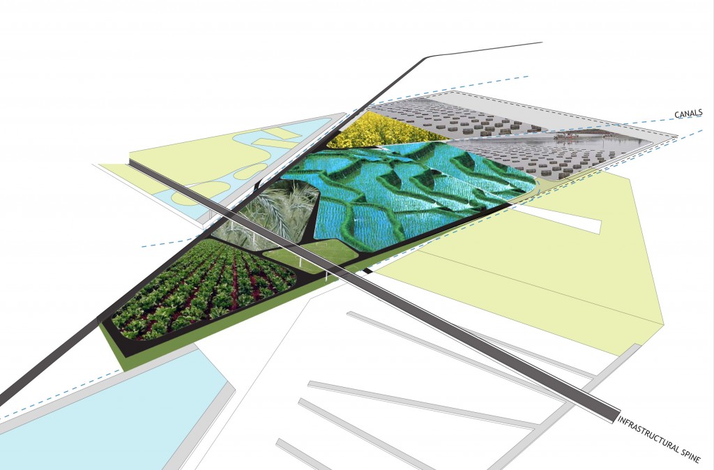
LTL Agri Aqua Wedge
Team LTL continues to explore opportunities for engagement between water and land through the deployment of wedge- or lozenge-shaped figures, established through sloped planes and surfaces. Last weekend’s Open Studios at P.S.1 offered a great opportunity to articulate the project’s premise, while also receiving input from attendees, including an insightful critique from Frank Gallagher who is leading the ecological restoration of Liberty State Park’s interior for the New Jersey Department of Environmental Protection. Recently, we have been looking more closely at specific programmatic and land-use adjacencies that can be generative on the site, trying to understand the project not just in terms of the presence and absence of water, but of water that is constantly in motion, flowing between landform and program and redefining each in its wake. We are aligning specific programs, integrating water forms and architectural sites, and experimenting with mapping particular types of use to each of the four proposed fingers that compose the reformed site: aquaculture/farm/testing; recreation; ecotourism; and regional/farmer’s markets. A specific feature will mark the end of each of these four fingers, acting as an attractor to the site and stitching Liberty State Park to the monuments that already exist on the site and directly offshore. Simultaneously, we are designing from water into land, pulling water-based activities and cultures back up to their previous historic boundary, now near the turnpike.
Watch Team LTL at work in the studio: [youtube]http://www.youtube.com/watch?v=bFR4FyGxNE8[/youtube]
Adam Yarinsky, Architecture Research Office (ARO)
ZONE 0:
Team ARO continues to explore a greater level of detailed analysis in our examination of the relative value of built and soft infrastructures. It is becoming increasingly evident that the project focus needs to consider a new non-wall condition at the perimeter of the island—a new ecological infrastructure. Formally, we imagined four ribbons of landscape snaking around the lower part of the island. The bands vary in width and include upland, fresh water wetland, salt water wetland, and structural tide pool landscapes. Our goal is to both protect the value of the city and enrich productivity. The paradox of increasing access while also enhancing protective landscape is being explored through a sectional weave similar to the transverse circulation systems of Central Park. New pedestrian, automotive, and public transport pathways across and through these sections will operate in a way that reveals the process of change.
Team ARO at work
Kate Orff, SCAPE Studio
ZONE 4:

SCAPE Site Transformation
Back to the future! SCAPE is reaching back to the past for clues as to how to reinvent New York’s harbor in new and exciting ways. In Colonial times our site was an archipelago of small islands interconnected by shallow tidal flats and meandering waterways that teemed with oysters and aquatic life. These landforms and watery shoals arched around Brooklyn from the marshy Gowanus Bay across to Red Hook, and stretched across a shallow Buttermilk Channel to Governor’s Island. It was said that during low tide one could walk from Governor’s Island to Brooklyn. Through centuries of cut and fill operations, these intricate edges have been dredged and hardened to allow navigation of bigger and bigger ships; the former small mountain on Red Hook was flattened; and a uniform one-hundred-foot-wide canal was carved out of the soft drainage basin to provide ship and barge access to inland industrial sites. Water quality has deteriorated as the city’s sewage pours into the canal through CSOs (combined sewage overflow) every time it rains and industrial byproducts seep into the waters from contaminants left behind by past industrial use. We aim to clean the water and clean the land in tandem: new CSO gardens and excavated sites together with an oyster-tastic wave attenuation reef grow in response to climate threats.
Eric Bunge and Mimi Hoang, nARCHITECTS
ZONE 3:
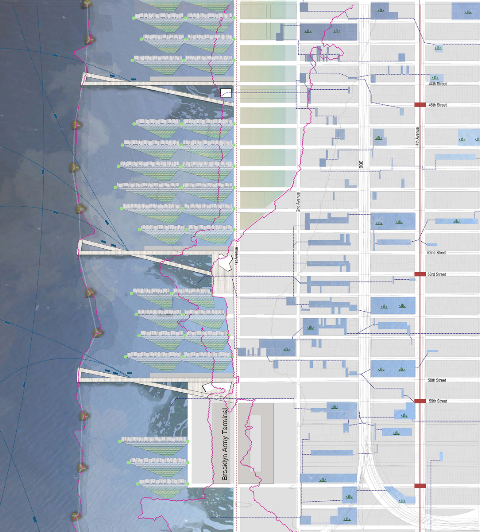
Detail of progress plan for Sunset Park, the northernmost area of nArchitect’s focus. View from west to east.
The Shipping Channel is forty feet deep. At depths of twenty to thirty feet, a line of islands, dynamically interconnected by inflatable barriers (only during storm surges). Piers/Storm Deflectors, extending the city grid from subway to ferry stops, and providing public squares and parks, could be built. On the down-current side of these, there would be habitat wetlands, formed over time on sediment. Between the piers,there would be elevated residential neighborhoods and floating mats of waste-treatment wetlands. Moving inland, up to the twenty-foot topographic line there would be housing on stilts above infiltration basins. Above the twenty-foot topographic line there would be a pervious network comprised of infiltration basins, swales, and culverts to absorb storm runoff, and when dry it would become a decentralized park.
Matthew Baird, Matthew Baird Architects
ZONE 2:
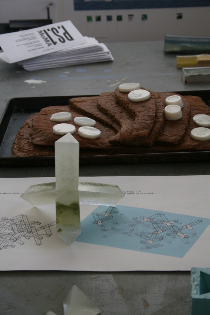
Team Matthew Baird at the P.S.1 Open Studio
“It is increasingly evident, I want to argue, that in the past three decades a new dimension of the capitalist production of nature has considerably transformed the social relationship with the natural world.” (Neil Smith, from Nature as Accumulation Strategy, 2007)
One consequence of global warming is the melting of polar ice caps. Besides contributing to rising sea levels, the disappearance of Arctic ice could profoundly affect future shipping routes by opening up the Northeast Passage. How will New York City fit into the new global shipping order, one where Reykjavik is a hub for Asia/Atlantic commerce? New York can become an important regional port. To support regional shipping, we need new regional economies. In a previous post, we mentioned producing reef-building units made from recycled glass. Along the Bayonne Pier on a strip we call the “waste line,” where our recycling plants are located, people will be able to explore (on foot or by car) the processes that convert trash into useful products. Hiking or driving in this reactivated post-industrial landscape connects people to a new natural order.