
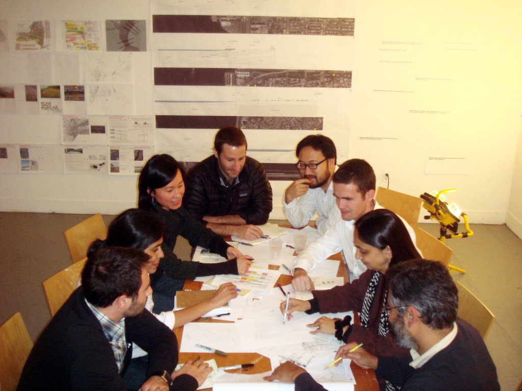
A back-to-school energy is percolating through the hallways of P.S.1 Contemporary Art Center, the historic public school building that serves as home to the interdisciplinary architecture-in-residence teams working on MoMA’s Rising Currents workshop and exhibition. In just two weeks the galleries have been transformed into research laboratories, and design strategies are quickly emerging amidst studio work, model building, site visits, collaborative consultations, visiting lectures, and pinup reviews. Below, each team weighs in on their site work to date.
ZONE 4: Kate Orff, SCAPE Studio
Oyster Gardening in the Gowanus Bay: Oyster reefs once covered the floor of the shallow New York Harbor, filtering water, attenuating waves, creating habitat for other species, and providing nourishment for those who settled along the harbor’s shores. Decimated by pollution and dredging, oysters had all but disappeared from the harbor. But they are now making a comeback with the help of dedicated people who seed the harbor with new oyster reefs. This week SCAPE boated out to the Bay Ridge Flats with partners and friends Bart Chezar, Pete Malinowski, the Harbor School student divers, Katie Mosher Smith of NY-NJ Baykeeper, and the Gowanus Dredgers to see oyster gardening in action. Our project for MoMA is taking shape, and with the help of the next generation of New Yorkers—and some oysters, eel grass, and mussels—we look forward to reimagining and rebuilding the future harbor together. Watch the video and see our Harbor School partners in action:[youtube]http://www.youtube.com/watch?v=ZkO1KSA-zKc[/youtube]
ZONE 3: Eric Bunge and Mimi Hoang, nARCHITECTS
After zooming into a series of sectional design studies, we zoomed out again and conducted some research on four topics, each of which provides parameters within a multilayered decision-making framework: water dynamics and “soft” infrastructure; history of land use; geology; and innovative approaches to “hard” infrastructure. Our working concept is “acupunctural”: to develop a series of “stations,” conceived of as seeds that could sponsor the growth of various systems and networks across the area of our site, whether ecological, programmatic, or infrastructural. With our consultants Mathur/da Cunha, we are imagining an aqueous city based on fluid and multilayered connections.
nARCHITECTS with Mathur/da Cuhna
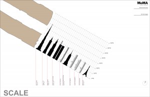
ZONE 2: Matthew Baird, Matthew Baird Architects
Our team began week one at P.S.1 with a focus on analysis, researching the site’s ecological, economic, and physical attributes, all with the backdrop of rising sea level. We’ve met with a series of experts in their fields—port planners, ecologists, oceanographers, artists, and urban planners—using their expertise to filter our initial ideas. Our site is dominated by three distinct districts: residential, shipping, and petroleum storage. We have begun a strategy that takes cues from sea level change as it relates to each district. For this reason our primary design tool is the section and section model. We are drawn to the Bayonne Piers, the tank farm and former site of Standard Oil’s Constable Hook Refinery, and to the steep and contrasting topography across the Kill Van Kull on Staten Island. Rather than embrace a master plan set in a specific time, we are engaging in a series of speculations that we hope capture the past and future spirit of this transitional landscape. We are keen on recording these speculations in collaboration with artists Mark Dion and Matthew Ritchie.
Matthew Baird Architects, Bayonne piers related to the tallest buildings and largest ships
Matthew Baird Architects, process sketch
Matthew Baird Architects, sketch rendering of design concept
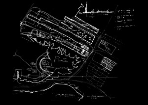
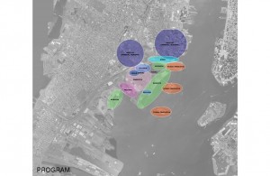
ZONE 1: David J. Lewis, Marc Tsurumaki, Paul Lewis, LTL Architects
Over the last week and a half, Team LTL has been closely examining Site 1 for its rich history, unearthing the legacy of transformation that has constructed the site over time. What is apparent to us is that this is truly a place where the natural and artificial are intertwined. We are currently developing a kit of tactical parts that can enable an opportunistic future to grow out of this complex legacy. By all projections, a vast majority of this site will be under the rising tide of water. How can the design invite and take advantage of the eventual flooding to generate the logic of form, prompting unprecedented spatial and programmatic conditions? How can the natural and artificial temporal patterns of the site—from the diurnal cycles of tides to the daily rush of commuters, from the seasonal transformations to the longer term patterns of flooding—be productively engaged through the staging of landscape, waterscape, and architecture?
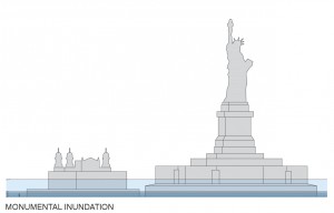
Monumental Inundation
LTL
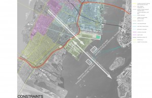
LTL site constraints
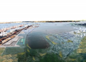
ZONE 0: Adam Yarinsky, Architecture Research Office (ARO)
ARO and dlandstudio are focused on researching how higher sea levels in the harbor will influence periodic events and conditions. What are the temporal processes that animate the Upper Bay? How will they change with the climate? Such events include the daily and seasonal fluctuations of the tides, but also the periodic occurrences of storms. We want our design to reveal these processes, and to link them to the life of the city. Some initial ideas include storm water filtering “inlets” that measure the inflow and outflow of water, and floating, articulated boom-like rafts that respond to the currents and dampen wave action.
ARO Water Table Study